Iceland’s third largest glacier is Hofsjökull
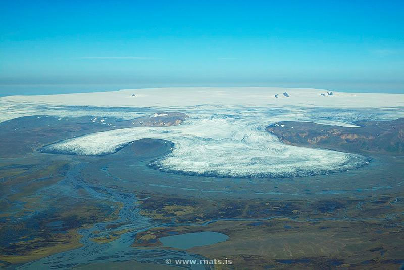
Hofsjökull (Temple Glacier) is the third largest glacier in Iceland, after Vatnajökull (Vatnajokull) and Langjökull (Langjokull) glaciers. Its massive ice cap covers a circular area of 925 km2, nearly 40 km in diameter, reaching 1,765 m (5,791 ft.) at its summit. Hofsjökull is situated in the western part of the Highlands of Iceland.
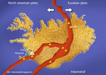
As is the case with many Icelandic glaciers, Hofsjökull’s ice cap conceals a dormant sub glacial, shield type volcano with caldera, also called Hofsjökull. Hofsjökull volcano lies along an east-west-trending area connecting the two principal rift zones of Iceland: the Reykjanes – Langjökull rift in the west, which terminates at Langjökull glacier, and the eastern zone, which extends north-eastward across east-central Iceland. The central caldera of Hofsjökull volcano is approximately 7 by 11 km large, and it lies beneath the western part of the Hofsjökull icecap. A small Holocene shield volcano is located at the south-western margin of the icecap. Flank fissures north and east of the icecap have produced basaltic lava flows during the Holocene; however, there have been no eruptions from the main crater for the last 12 000 years.
Hofsjökull glacier is the source of several rivers including the þjórsá (Thjorsa) which, at 230 km, is Iceland’s longest river. As well as the Thjorsa, Hofsjökull’s meltwaters feed several other rivers, including the Héradhsvötn (Heradsvotn), Ölfusá (Olfusa), and Blanda.
Kerlingarfjöll
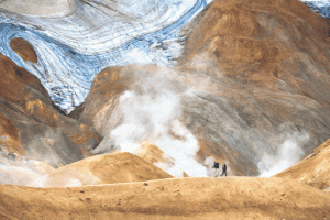
Located south-west of the Hofsjökull icecap, are the Kerlingarfjöll (Kerlingarfjoll) mountains, which derive their name from a 25 m high stalwart pillar, believed (in folklore) to be a troll woman (‘kerling’ in Icelandic) who turned to stone at dawn. Glacially carved, covering around 150 km2, Kerlingarfjöll mountain range is considered part of the Hofsjökull volcanic system. Steep-sided Pleistocene rhyolitic lava domes characterize the area, with numerous hot springs located around the two calderas at the centre of the approximately 5 by 7 km wide complex. The volcanic origin of the mountains is also evidenced by the extremely lively fumaroles’ activity at Kerlingarfjöll, as well as by the extraordinary red-hued earth colours which are due to the volcanic rhyolite stone from which the mountains are composed.
Not surprisingly, the singular beauty of the landscape, its rarely seen extraordinary colours and remarkable shapes, along with the sense of, unquestionably, being ‘away from it all’, make Kerlingarfjöll mountain range immensely popular with hikers. The mountain peaks rise 800–1,500 m above sea level, across an area interspersed with ravines, canyons, glacial parts, mountain passes, amazing volcanic formations and steamy geothermal spots featuring ethereal colours, along the many hiking trails.
Kjölur Highland Road which lies between the Langjökull and Hofsjökull glaciers makes the area accessible, driving along the Hellisheiði (Hellisheidi) heath in 4WD vehicles. Most Highland routes involve crossing unbridged rivers.
Travelling through the wilderness of Iceland’s Central Highlands is a truly unique experience. Such a journey is safest, most rewarding and most enjoyable when accompanied by experienced local driver guides in a super jeep, vehicle specially modified for Icelandic hinterlands conditions.


