Grimsvötn volcano, the subglacial dweller at Iceland’s Vatnajokull
Grímsvötn volcano is situated near the centre of the vast Vatnajökull (Vatnajokull) ice cap in central Iceland. It has the highest eruption frequency of all the volcanoes in Iceland. Grímsvötn volcano has a complex of calderas, about 6 by 8 km in area, and a subglacial caldera lake sustained by geothermal heat. The caldera lake is covered by a 200 m thick ice cap. Beneath the lake is the magma chamber of the Grímsvötn volcano.
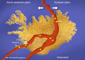
Grímsvötn is the central edifice on a long set of NE-SW trending fissures. Bárðarbunga (Bardarbunga) is a part of a fissure system that extends along the west side of Vatnajökull and lies close to where the Mid-Atlantic ridge comes on land in Iceland. Located NW of Grímsvötn volcano, it contains two subglacial ridges. Any eruptions at Bárðarbunga potentially affect subglacial drainages in all directions.
Vatnajökull ice cap, the home of the Grímsvötn volcano, covers around 8300 km2 (8%) of the landmass of Iceland. As well as Grímsvötn, the ice cap covers at least six other subglacial volcanoes, including Öræfajökull (Oraefajokull). Each of the volcanoes is part of a volcanic fissure system traversing the whole area. The most prominent is the Laki fissure swarm, which, during an eruption in 1783, produced the world’s largest known historical lava flow.
Laki-Lakagígar eruption
The 1783 eruption at Laki (“Skaftar Fires”) produced 14-15 km3 of basaltic lava. Laki or Lakagígar (Craters of Laki) fissure is part of the Grimsvotn volcanic system. The 1783 eruption started on June 8, when the torrent of lava surged down the river bed of Skaftá (Skafta) river, filling the Skaftá gorge. Over an eight-month period, from June 1783 to February the following year, the basaltic lava that flowed out of the Laki volcanic craters covered an area around 600 sq. km (230 sq. mi). It is thought that the lava flow was as much as 6000 cubic metres per second; that the fire fountains were between 800-1400 metres (2500-4500 ft.) tall, and the column of ash is estimated to have risen to a height of 15 km (9 miles).
Grímsvötn eruptions
Eruption frequency of the Grimsvötn centre during past centuries has been close to one eruption per decade. Small eruptions have occurred at the volcano in 1983 and 1998. In 1996 a subglacial eruption occurred north of the volcano at the Gjálp (Gjalp) eruptive site, between Grímsvötn and Bárðarbunga. These were explosive eruptions. Two more eruptions occurred, one in the autumn of 2004, the other in the spring of 2011.
2004 Grímsvötn eruption
In late October 2004, earthquake activity at Grímsvötn increased. On October 26, high frequency seismic tremor indicated increased water flow from the caldera lake, signifying that a glacier outburst flood, jökulhlaup, was about to begin. On October 29, discharge increased in the river Skeiðará (Skeidara). The outburst flood was caused by high water level in the Grímsvötn caldera lake, from ice melting due to geothermal activity. The release in overburden pressure associated with jökulhlaup triggered the eruption. The drop in water level in the Grimsvötn caldera at the onset of the eruption is uncertain, but it was probably around 10-20 metres, corresponding to a pressure change of 0.1-0.2 MPa on the volcano surface. This modest pressure change triggered the eruption because the internal pressure in the Grímsvötn shallow magma chamber was high after continuous inflow of magma to the volcano since 1998.
The eruption started late in the evening on November 1. An intense swarm of volcanic earthquakes that had begun about 3 hours earlier changed at that time to continuous low frequency tremor, indicating onset of an eruption. Weather conditions prohibited direct observations of the beginning of the eruption. The plume height reached 12-14 km, but the high plume phase lasted only a few days.
2011 Grímsvötn eruption
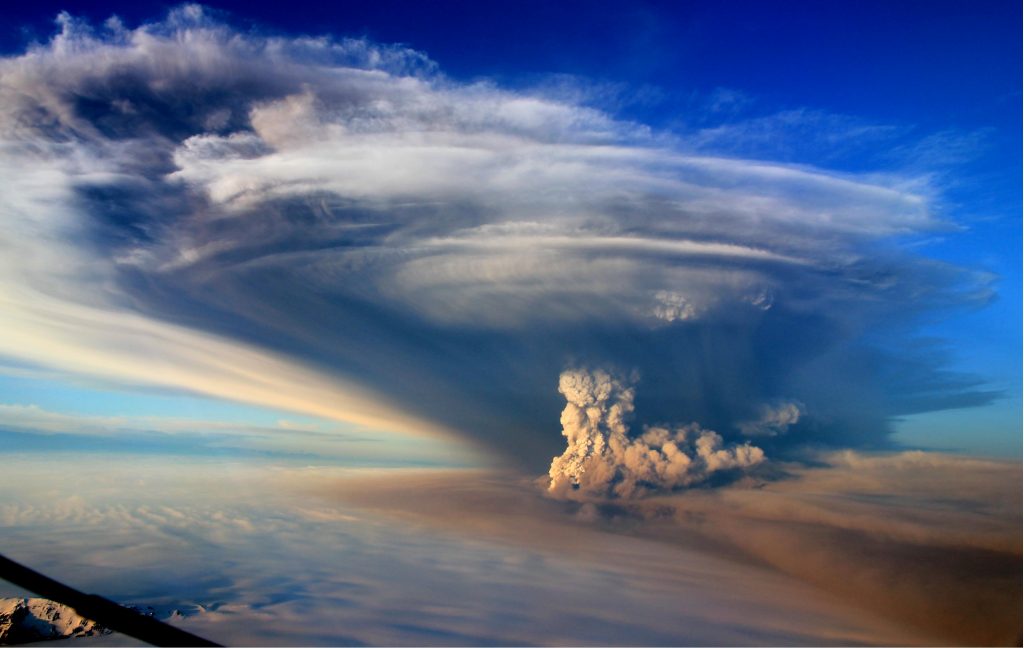
The eruption occurred between 21 May and 28 May 2011. The ash plume rose to heights of over 17 km at the start of the eruption, but reduced to around 10 km during 22 May, and to less than 7 km by 24 May. The explosive nature of the 2011 Grímsvötn eruption was due to the interaction of hot magma with ice and water, producing ash particles. Little ice meltwater was produced, and glacial outburst flood, although anticipated, did not occur.
Within the ice filled Grimsvötn caldera, intense geothermal activity continuously melts the ice surrounding the subglacial lake which, at intervals of 5-10 years, is emptied along subglacial channels, creating large glacier outburst floods on the sand plain Skeidararsandur, on Iceland’s south coast. The geothermal area in the caldera causes a jökulhlaup to occur whenever melting raises the water level high enough to be able to lift its glacial ice dam. GPS measurements show uplift of 5-10 cm/year in the caldera centre, and horizontal displacements away from the caldera.


